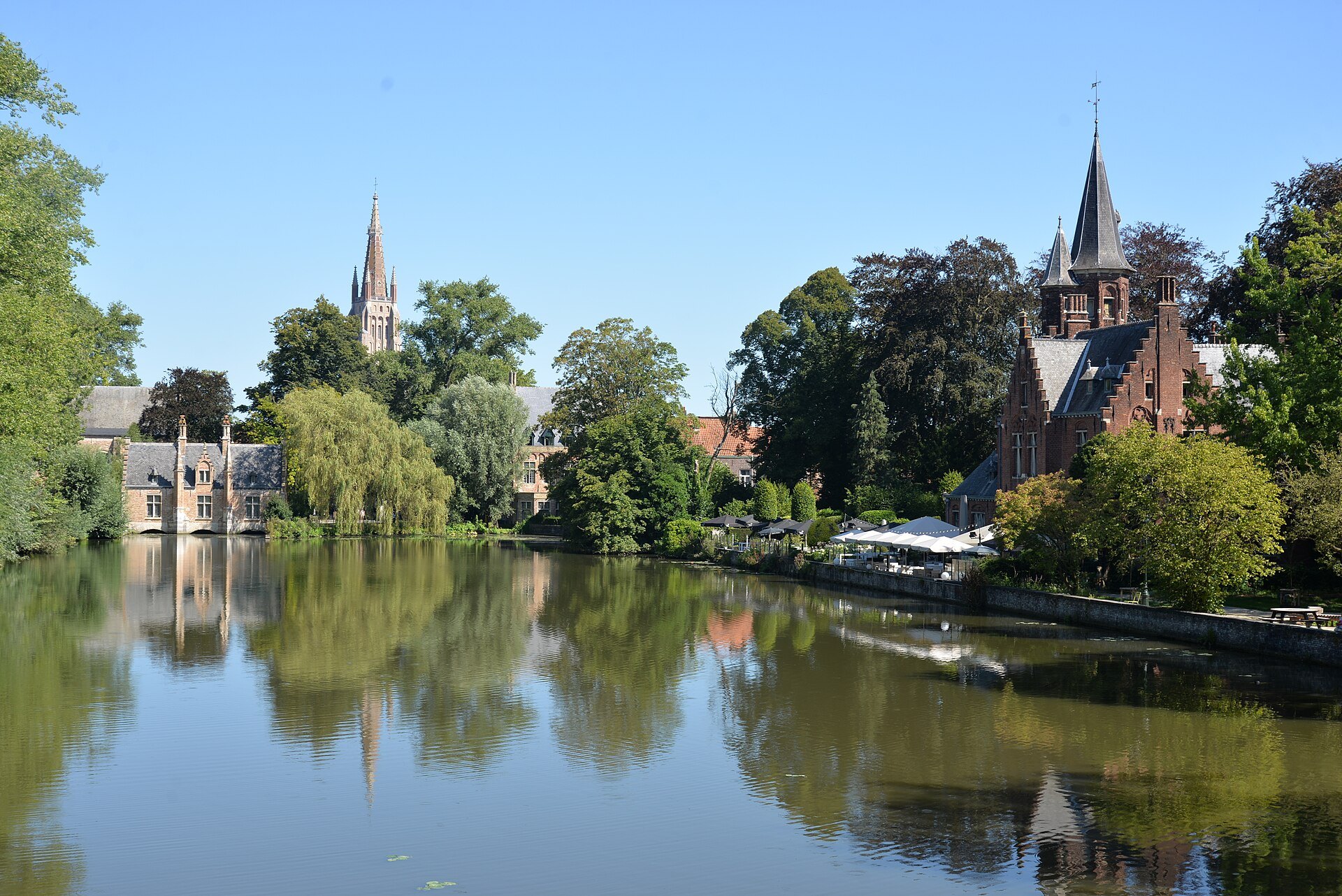
A broad sheet of water beside the Beguinage, dug in the thirteenth century to control the river flowing into Bruges, framed by a park, a sluice house, a brick powder tower and a neo-Gothic castle.
The parts to look at
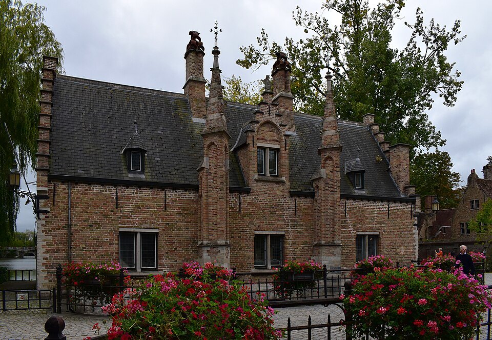
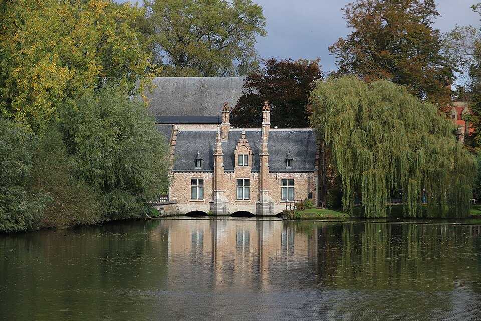
- IThe Sas HouseThe old sluice house at the northern end, beside the Beguinage gate
- IIThe Minnewater bridgeThe bridge across the water with the view north to Our Lady's spire
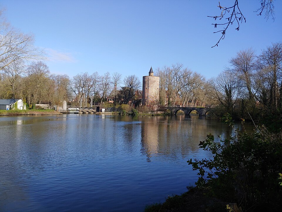
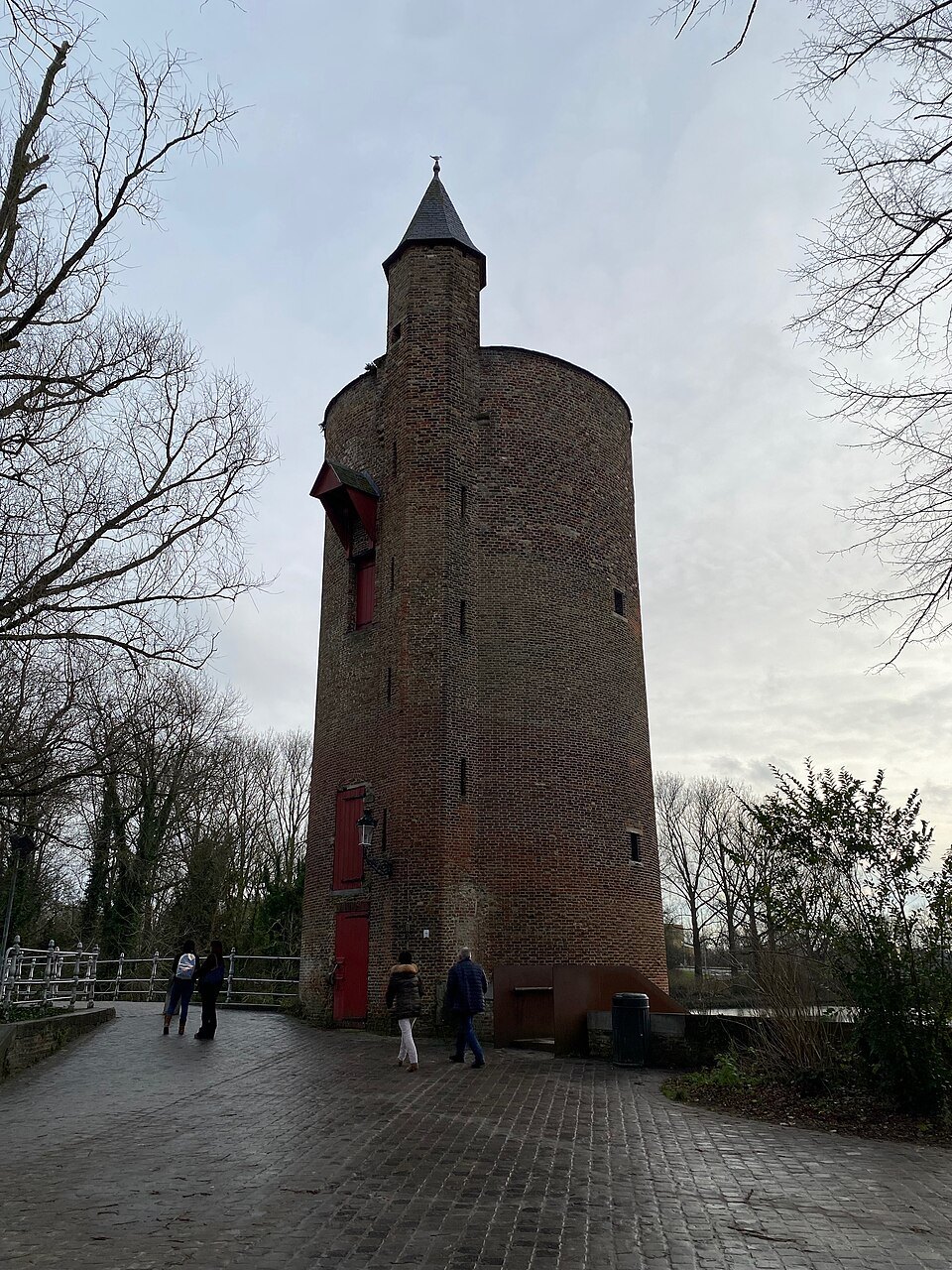
- IIIThe PoertorenA brick tower of 1398 to 1401 that once stored gunpowder
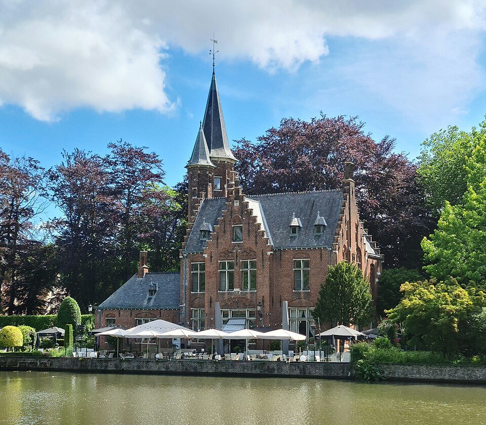
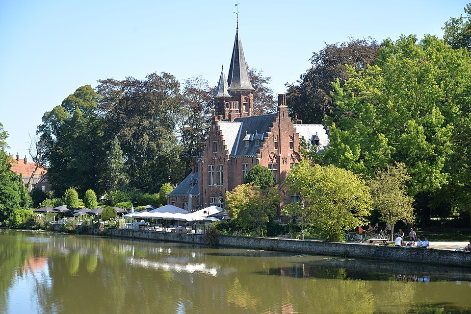
- IVKasteel de la FailleA neo-Gothic castle of 1893 on the eastern shore
- VThe parkLawns and trees along the western bank
- VIThe rampartsThe green ring of former walls that begins at the lake's southern end
Inside the walls, from the gate inwards.
Why it matters
At the southern edge of the old town the canal suddenly widens into a lake. Willows hang over the water, and to the north the spire of the Church of Our Lady rises above the trees. The Minnewater is the gentlest landscape in Bruges and a welcome open space after the tight streets of the center.
It is also a working piece of water engineering, older than almost anything around it, and the setting for one of the city's favorite stories, which is a legend rather than history.
A reservoir, not a lake
The Minnewater is not a natural lake. It was created around the thirteenth century as a buffer basin to control the water of the Reie, whose unpredictable flow could flood the city. By holding and releasing water here, Bruges could keep the level of its canals steady.
It was also a harbor of sorts. Until 1784 the Minnewater was the mooring place of the barge that linked Bruges with Ghent, so this quiet spot was once a point of arrival and departure for travelers and goods.
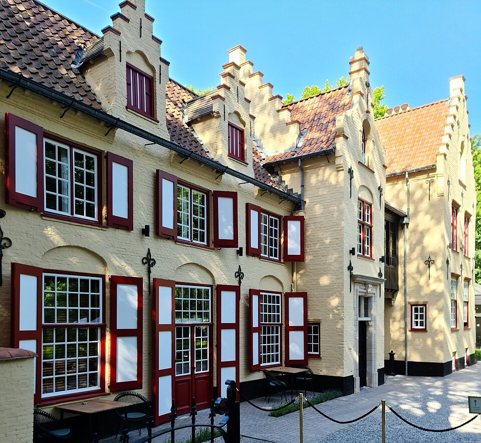
The old sluice house, the Sas House, still stands at the northern end beside the Beguinage, a reminder that the water here has always been managed rather than simply admired.
That job shaped the city for centuries. Without a way to hold back and release the Reie at this end of town, the canals that now carry visitors' boats would have flooded the streets or run low, and the quays of the center would look very different.
The Lake of Love
Guides and signs often call the Minnewater the Lake of Love, because minne is an old Dutch word for love. A romantic legend tells of a young woman named Minna who died for love, and of her lover Stromberg, who dammed a stream to create a lake in her memory and carved her name on a stone.
It is a lovely story, and it is only a legend. Scholars disagree about where the name really comes from. Some suggest middenwater, a basin in the middle; others connect it with an old word for controlling water, with a word meaning municipal, or with the nearby Minnebrug bridge and medieval folklore about water spirits living near bridges. None of these explanations has settled the question.
What you actually see
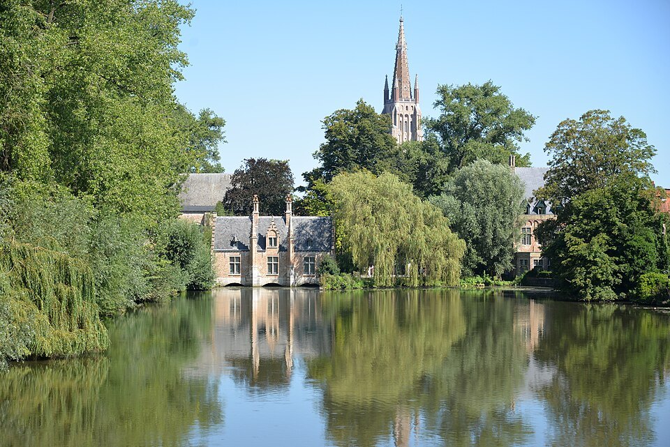
Enter from the Beguinage end, past the Sas House, and walk onto the Minnewater bridge for the classic view: the lake stretching away, and to the north, looking back, the tower of Our Lady above the trees and roofs. On still days the reflection is almost perfect.
At the southern end stands the Poertoren, a brick tower built between 1398 and 1401 by the master mason Jan van Oudenaerde as part of the city's defenses. Over the centuries it was used to store gunpowder and, later, ice.
On the eastern shore, among trees, is Kasteel de la Faille, a neo-Gothic castle built in 1893 by the architect Karel De Wulf. It is a nineteenth-century romance in brick, not a medieval fortress, but it suits the lake. The western bank is a public park with lawns and paths.
Where the ramparts begin
The Minnewater marks the southern end of the green ring that surrounds the old town. The ramparts were raised during the city's second expansion, between 1297 and 1301, first as earthen banks and moats with gates on the main roads; walls between the gates followed in the late fourteenth and early fifteenth centuries, and bastions were added from 1614.
In 1782 the city decided to dismantle the fortifications, which no longer had any military purpose. Over the following century the ramparts were turned into a landscaped park, with designs approved from 1853 onwards and projects continuing until 1915. The whole ring, with its paths, trees, gates and mills, was given protection as a cityscape in 2016.
For a visitor it is the best long walk in Bruges: a loop of green paths beside the outer canal, away from traffic, with the windmills and the city gates along the way. Starting at the Minnewater and heading east along the ramparts brings you past the Gentpoort to the mills on the Kruisvest.
How to visit
The Minnewater and its park are public and free, and you can walk round the lake in about twenty minutes. It is best early in the morning, when the water is calm, and in the evening light, when the reflections of the trees are at their strongest.
The lake is a few minutes' walk from the station, which makes it a gentle first view of Bruges for anyone arriving by train. Many visitors walk from the station through the Minnewater park and the Beguinage into the center.
From the southern end you can continue along the ramparts, the green belt of former walls that circles the old town, towards the city gates and the windmills; see the city gates.
Nearby
The Beguinage is right at the northern end, and St. John's Hospital and Our Lady are ten minutes' walk further on. The Walplein, with its brewery and café terraces, lies between the lake and the center, and getting here explains the walk from the station.
Nearby
- The quiet southThe BeguinageA walled enclosure of white houses round a lawn of tall trees, founded for beguines in the thirteenth century and home…Read the page
- Along the DijverChurch of Our LadyThe church whose brick tower rises over the south of Bruges, holding a marble Madonna by Michelangelo and the tombs of…Read the page
- Along the DijverSt. John's HospitalOne of the oldest surviving hospital buildings in Europe, where Augustinian sisters cared for the sick for eight…Read the page