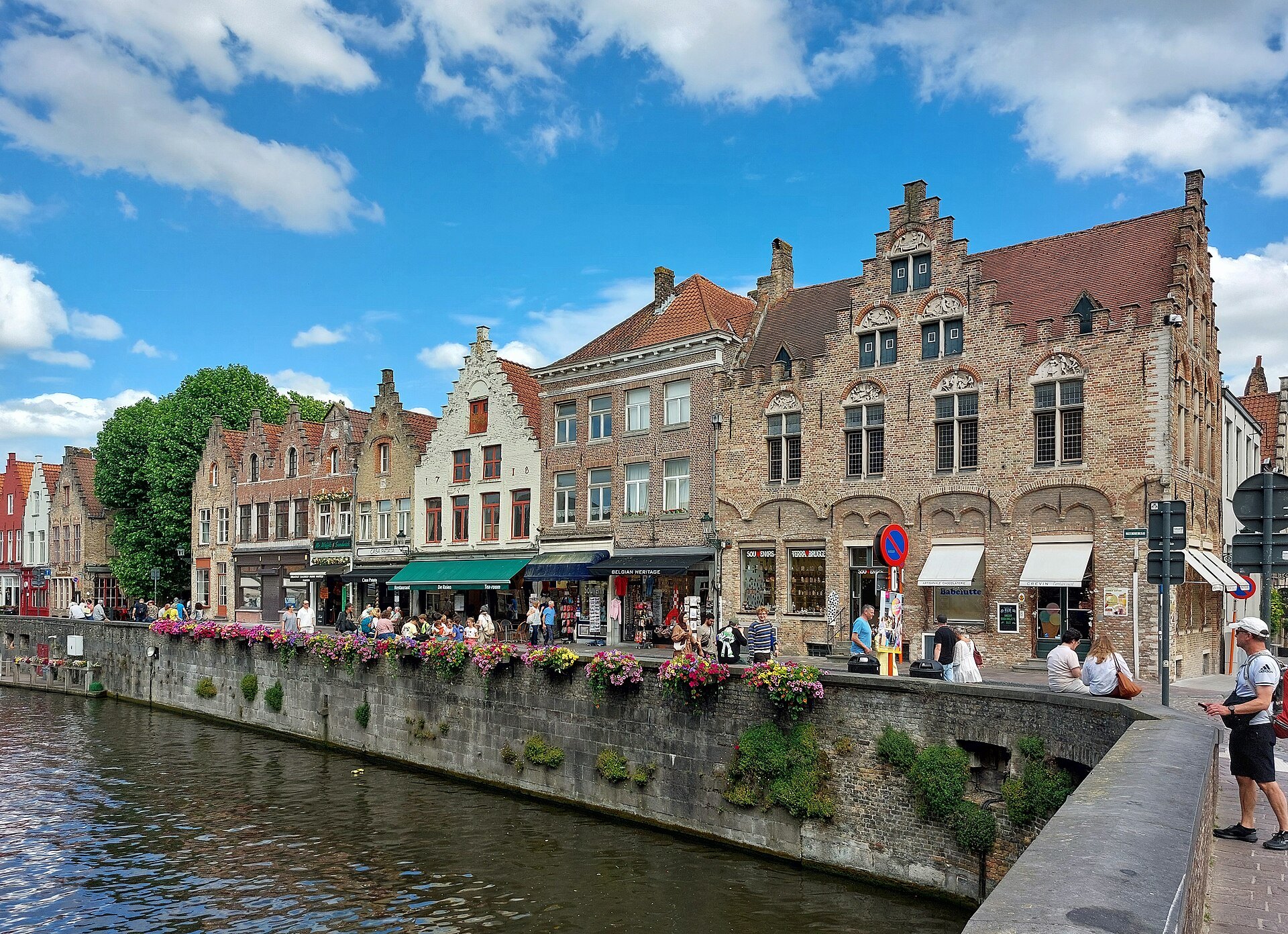
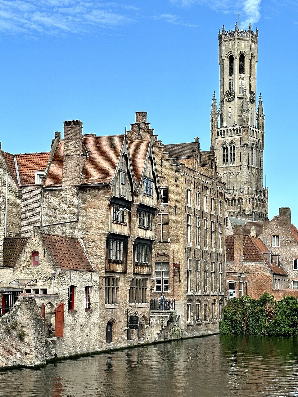
The bend of quay where the canal turns under brick houses and the Belfry rises behind them, once the salt quay of Bruges and now the view that stands for the whole city.
Along the quay
- 1HuidenvetterspleinA small square of guild-style houses, with a boat landing stage by the water
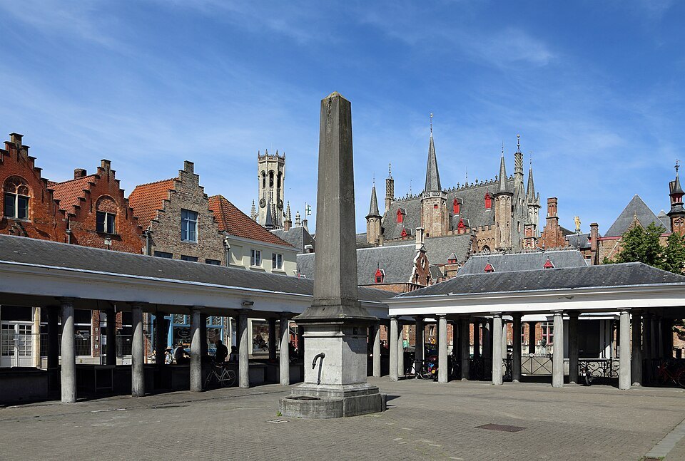
- 2The fish marketThe colonnaded market by Braambergstraat, where the fish trade moved from the Markt
- 3The quay wallFlower boxes on the stone parapet where everyone stops to lean and look
- 4The bend of the canalBrick fronts rising straight from the water, the Belfry above their roofs
- 5The boat stageOne of the five landing stages where canal boats take on passengers
- 6Towards the DijverThe quay continuing south along the canal towards the museums
Along the water, in the order you meet them.
The view everyone comes for
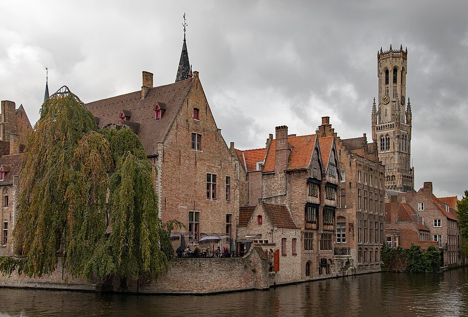
There is a moment, walking south from the Burg, when the street opens onto the water and the whole of Bruges seems arranged for a painting: a bend of dark canal, old brick houses standing straight up out of it, a willow, and above everything the tower of the Belfry. That is the Rozenhoedkaai. It is one of the most photographed places in the city, and it earns the attention.
The quay is short, and there is not much to do here except look. That is the point. It is the best place in Bruges to understand how closely the town and its canals are woven together, and to see why the city is so often compared with Venice.
Salt, rosaries and a novel
For centuries this was not a picturesque corner but a working wharf. The street was called the Zoutdijk, the salt dike, and a reference from 1390 suggests that ships delivering salt were unloaded here. Salt was one of the essential goods of medieval trade, and Bruges was built on trade.
The present name appeared in the eighteenth century. Stalls selling rosaries, rozenhoeden in old Dutch, were set up along the quay, and the name stuck. A rosary quay suited a city whose churches and religious houses were everywhere.
In 1892 the Belgian writer Georges Rodenbach published Bruges-la-Morte, a novel about a widower wandering a silent, melancholy city, and he gave his main character a house on the Rozenhoedkaai. The book helped build the image of Bruges as a dreamlike place frozen in time, and that image still draws visitors to this quay.
What you actually see
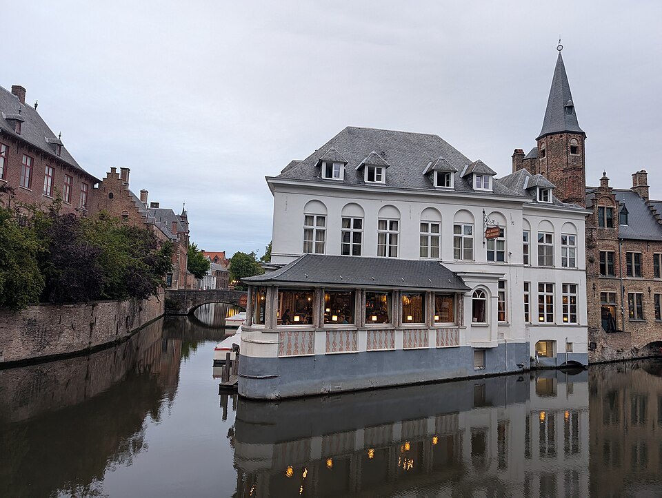
Stand at the quay wall and look along the water. On the far side the houses rise sheer from the canal, their brick fronts and stepped gables reflected in it, and behind them the Belfry fills the sky. To your right the canal bends out of sight; to your left it runs on towards the Dijver and the museums. A large building with a terrace directly on the water is part of the view in almost every photograph taken from here.
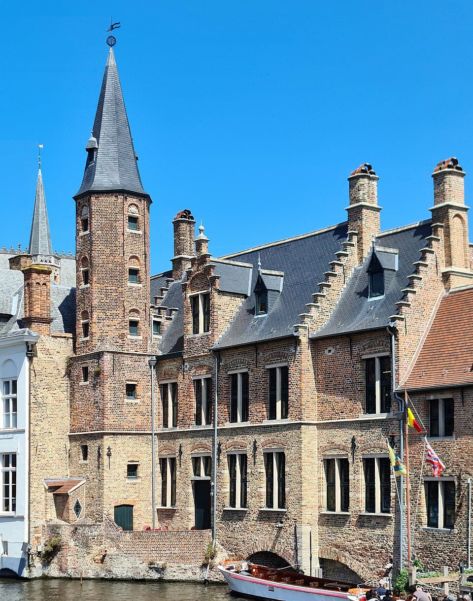
Close by is the Huidenvettersplein, a small square named after the tanners, with the tanners' old guild house on its corner and houses that face the canal behind. It holds one of the city's boat landing stages. A few steps further on is the fish market, the colonnaded market by Braambergstraat; the fish trade moved there, away from the Markt in 1745.
Along the quay itself the parapet is lined with flower boxes, and there is almost always a canal boat passing below, full of upturned faces. Look for the moment when a boat crosses the reflection of the Belfry; that is the photograph most people wait for.
Taking the photograph
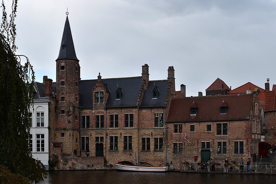
The light is best in the morning, when the sun falls on the houses across the water and the quay is still quiet. By late morning in the warmer months the parapet is crowded, and you may have to wait your turn at the best spot. Evening is also rewarding: the Belfry and the houses are lit, the boats have stopped, and the canal becomes very still.
You do not need to stand exactly where everyone else does. Walk a few meters along the quay in each direction and the angle on the tower and the bend changes. Crossing to the Huidenvettersplein gives a lower view with the houses closer, and the bridges further along the Dijver give yet another.
How to visit
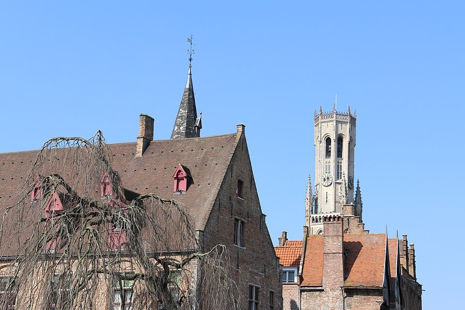
The quay is a public street, open at all hours and free. Ten minutes is enough to see it; longer if you want to photograph it well or simply sit and watch the boats. It is a natural stop between the Burg and the museums on the Dijver, and most walking routes through the center pass it.
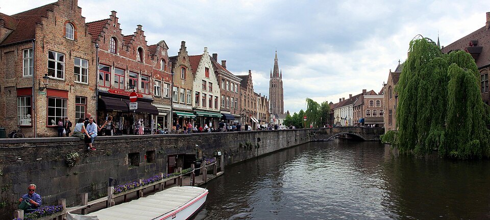
The boats that leave from here and from the Huidenvettersplein are the easiest way to see the canals from the water. A trip takes about half an hour, tickets are sold at the landing stages, and the boats have no roof, so umbrellas are handed out if it rains; the canal boats page explains how it works.
The steps down to the landing stages are steep and there is no lift, so the boats are not wheelchair accessible. The quay itself is level and easy to reach, and the view from the parapet costs nothing and needs no planning at all, which makes it one of the few famous sights in Bruges that is never sold out.
Where to go next
Follow the water south and the quay becomes the Dijver, with the Groeningemuseum and the tree-lined canal and, beyond it, the Gruuthuse and the Church of Our Lady. Walk back north through the fish market and the Blinde Ezelstraat arch to reach the Burg, or turn along the Groenerei for the quietest stretch of canal in the center.
Nearby
- Along the DijverThe DijverA tree-lined stretch of canal south of the Rozenhoedkaai, where the Groeningemuseum, the Gruuthuse and the College of…Read the page
- The two squaresThe BurgThe square where Bruges began as a fortress of the counts of Flanders, now ringed by the Gothic City Hall, the Holy…Read the page
- Along the DijverThe Canal BoatsOpen boats that carry visitors round the inner canals of Bruges in about half an hour, from five landing stages in the…Read the page